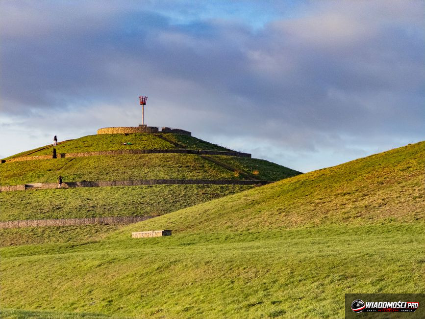
Laser scanning in Coëby has revealed hidden layouts of burial chambers; however, as of August 3, 2026, detailed technical reports remain in the phase of scientific verification. These data indicate the presence of symmetrical structures with dimensions typical of Neolithic necropolises in the region. The INRAP team has identified specific anomalies with geometry suggesting intentional human activity, which are changing the existing archaeological map of Brittany.
LiDAR technology, or Light Detection and Ranging, currently forms the foundation of work on the cultural landscape of France. A laser sensor sends thousands of light pulses per second toward the ground, which allows for precise surface mapping even through dense vegetation. Every photon reflected from the forest floor or branches is recorded, enabling the generation of a digital elevation model with centimeter-level accuracy. Specialists from the CNRS use this capability to digitally remove the tree layer, revealing what has remained invisible for centuries to researchers traversing the Breton fields.
The process of creating a digital terrain model requires filtering out so-called noise, i.e., data representing vegetation. Algorithms processing the information from Coëby separate plant points from the ground. On a map prepared in this way, the geometric shapes of burial chambers emerge, the symmetry of which goes beyond natural rock formations. The regularity of these structures has become the basis for launching a broad comparative analysis. LiDAR does not replace traditional excavations, but it identifies places where soil intervention has the highest probability of success. Thanks to this, scientists optimize expenditures, avoiding costly research in places that do not hide any anthropogenic structures.
The interpretation of raw data is a tedious and risky stage. Generating a 3D model does not end the research process. Every detected anomaly undergoes an assessment by geomorphology specialists, who rule out natural landslides and karst processes. In Coëby, scientists are facing the challenge of distinguishing ancient stone constructions from clusters of erratic boulders, typical of this region of France. Breton geology can be deceptive, which is why every outline on the monitor must be verified based on knowledge of the local bedrock.
Brittany is the area with the highest concentration of megalithic structures in Europe. Burial mounds, dolmens, and menhirs create a unique cultural landscape, formed between 4500 and 3000 BC. Neolithic communities developed advanced engineering techniques there that still command the admiration of researchers today. Transporting multi-ton stone blocks over significant distances without the use of modern lifting equipment required strict social organization. Coëby represents the missing link in understanding how these communities managed the space around their necropolises. Previous studies by the University of Rennes suggested that the region was densely populated, but there was a lack of evidence for the existence of such extensive underground structures.
Confirming hypotheses about the symmetrical layout of the chambers forces a revision of the concept of hierarchy within Neolithic clans. Burial systems of this type served sepulchral, sacred, and political functions, acting as gathering centers for local communities. Every new discovery in Coëby updates the settlement map. The problem remains that most of these objects are hidden under layers of arable land or dense vegetation. Laser scanning allows for a glimpse into this hidden fabric without disturbing the historical structure. This conservation-oriented approach places heritage protection above the ambition of quick discoveries. Scientists fear that premature publication of data could trigger uncontrolled tourist traffic or interest from treasure hunters, which would be catastrophic for such a delicate site.
The analysis of the point cloud from Coëby yielded two main discoveries. The first is the identification of a precise, symmetrical layout of burial chambers. Their geometry points to spatial planning that goes beyond previously known forms of construction in this area. The second element is the detection of external perimeter structures, defined in literature as a "rondel." These are circular embankments or ditches that marked the boundaries of the sacrum, separating the burial site from the daily life of the settlement. The presence of these structures suggests that Coëby functioned as a center of regional importance, where rites of passage took place in a strictly defined architectural order.
Experts from INRAP point to traces of secondary modifications to the chamber layout. This suggests that the site was used for several generations, and each subsequent phase of construction referred back to the original design. Maintaining orientation relative to astronomical phenomena is characteristic of the Neolithic, which confirms the intentionality of the ancient builders' actions. Skeptics note, however, that a digital image can be treacherous. The line between intentional human action and geological erosion is thin. Symmetry on monitors may be the result of a specific arrangement of rock layers in the subsoil. To rule out this scenario, it is necessary to conduct geological boreholes and trial excavations. Only the physical discovery of ceramics or tools will allow for precise radiocarbon dating, which will finally confirm the age of the structure.
The discoveries in Coëby call into question theories about the "primitiveness" of Neolithic builders. If the chamber systems were designed with such accuracy as the scans suggest, knowledge of geometry and engineering was much more advanced in Brittany than was thought even a decade ago. Old assumptions, according to which burial mounds were merely chaotically piled mounds with a central chamber, lose their validity in the face of such a complex network of corridors. This revision also concerns the social status of the people buried in Coëby. Previous methodology assumed that the size of the mound directly correlated with the rank of the deceased. Now we see that the interior – its complexity, the number of chambers, and the way they are connected – was the determinant of prestige. Access to certain parts of the tomb was likely restricted only to selected members of the community, which testifies to deep social stratification.
Researchers from the University of Rennes point out that if such extensive systems were indeed hidden inside smaller mounds, then previous studies may have missed dozens of similar sites throughout the region. LiDAR is becoming a tool that allows us to see the "other side" of history. We are no longer looking at a single object, but at a coherent system in which each burial mound was part of a larger, well-thought-out landscape management strategy. This systemic approach is a new standard in Stone Age research.
Working with LiDAR data is balancing on the edge of science and interpretation. Every point in the cloud is only information about height, not function. The research team in Coëby must face the enormous responsibility of giving this data historical meaning. The lack of haste in publishing official reports is dictated by the desire to avoid cognitive errors. The history of archaeology knows cases where "sensational" discoveries based on imaging turned out to be merely digital artifacts resulting from algorithm imperfections. The challenge is not to succumb to the temptation of fitting data to a preconceived thesis. If researchers are looking for evidence of chambers, the software may highlight outlines that are, in reality, merely random terrain irregularities. That is why it is so important to maintain distance from 3D visualizations. For a scientist, they are only a preliminary stage of work.
The final arbiter remains physical inspection. The research team identifies critical points, i.e., places where scanning indicates the greatest architectural complexity. Archaeological work will be directed there. Only after excavating a fragment of a wall or passage will it be possible to confirm whether we are dealing with a work of human hands. This process is expensive and time-consuming, but it is the only path to historical truth. Research plans for the coming years assume the creation of a complete digital archive for all of Brittany. Coëby is becoming a testing ground in this process. The success of this scanning method opens the way for broader funding of research by European heritage protection funds. The goal is to create an interactive map that will allow archaeologists to conduct comparative analyses in real time.
International cooperation, involving institutions from France, Germany, and Great Britain, is intended to ensure objectivity in the interpretation of results. Avoiding local blindness, where researchers accustomed to the specifics of the region might overlook details obvious from the outside, is crucial for the success of the project. In the coming months, it is planned to make part of the raw data available to other scientific teams, which is intended to enable independent verification. Archaeology is becoming a science increasingly dependent on computer science. However, it is the human who remains the one who must ask the right questions. Is Coëby an exception or the rule? Are the detected chambers graves or perhaps vaults? Not even the most powerful processors in the world will answer these questions. They will be answered only by months of hard work in the field, during which the visions from the monitors will collide with the hard reality of earth and stone.
For the average recipient, the discovery in Coëby is proof that our history still hides secrets from us. Thanks to LiDAR technology, we no longer have to destroy monuments to learn about their construction. We gain knowledge about our ancestors while respecting the integrity of places that have remained untouched for millennia. However, this is a process in which haste is a bad advisor. True breakthroughs require time, patience, and, above all, verification that will separate sensational reports from archaeological facts.
Questions and answers
Does laser scanning damage monuments?
No, the LiDAR method is fully non-invasive. It consists of emitting light beams that have no physical impact on the structure of the terrain or the objects hidden beneath it.
Why is the discovery in Coëby being talked about only now?
Processing data from LiDAR is a process requiring enormous computing power and time. The research team had to conduct multi-stage verification to ensure that the readings were not software errors.
Can this site be visited?
Currently, the site in Coëby is under strict conservation protection and remains inaccessible to outsiders. Research work is being conducted there, and the area is monitored to prevent degradation of the monument and uncontrolled excavations.
Which institutions are conducting research in Coëby?
The main work is coordinated by the National Institute for Preventive Archaeological Research (INRAP) in cooperation with scientists from the French National Centre for Scientific Research (CNRS) and specialists from the University of Rennes.
Can LiDAR see through concrete?
This technology allows for penetration through vegetation and certain types of loose sediments, but it is not able to see through solid building structures. Its effectiveness in archaeology is based mainly on detecting differences in terrain topography, which may indicate the presence of underground structures.
When will we know the verification results?
Official reports will be published after the completion of fieldwork and scientific peer review, but the exact date has not yet been given by the research team, as it depends on the progress of the trial work.
Will this discovery change history textbooks?
If the hypotheses about the uniqueness of the architecture in Coëby are confirmed, it will require updating theories regarding the level of advancement of Neolithic communities in Western Europe. Currently, however, this discovery is treated as an important piece of the puzzle, not its finished picture.
Modern archaeology requires us to understand that every interpretation of digital data is only a working hypothesis. In the case of Coëby, researchers must show great restraint. Enthusiasm resulting from 3D visualization is natural but must be curbed by rigorous methodology. It is not enough to see a shape on a screen; one must understand its context, function, and chronology. The INRAP team is aware that the eyes of the entire scientific world are turned toward Brittany. Any error in interpretation could undermine trust in the LiDAR-based methodology that currently dominates research on prehistory.
Coëby is not the only place in Europe where laser technology has revealed potentially significant structures. Similar studies conducted in other regions of France and in Great Britain show that our image of the Neolithic was previously too simplified. It was often assumed that Stone Age communities were scattered and poorly organized. Today's evidence from LiDAR suggests the exact opposite – an advanced network of centers with a strong hierarchy and precise spatial planning. If these assumptions are confirmed, we will have to completely redefine our understanding of the social organization of the Neolithic.
An important aspect remains the issue of data access. In the era of Open Science, there is growing pressure to share raw scan results. The team in Coëby faces a dilemma: on one hand, they want to enable independent verification by other centers; on the other hand, they fear premature conclusions drawn by amateurs. This balance between transparency and site protection is one of the greatest challenges for archaeologists today.
The future of archaeology in Brittany is closely linked to the development of artificial intelligence algorithms, which in the future may analyze point clouds even faster. Currently, however, it is the human expert who remains the one who must make the final decision. Is a given terrain outline the foundations of a tomb, or perhaps a natural remnant of an old riverbed? This decision carries consequences for the entire scientific community. Each confirmed site is another piece in the puzzle of human history.
We cannot forget that LiDAR is only one method. In modern archaeology, an interdisciplinary approach works best. Combining laser scanning with geophysical research, soil analysis, and radiocarbon dating provides the most complete picture. Coëby is an excellent example of this work model. We do not rely on only one source of information. We verify sensor data with boreholes, and these, in turn, are supplemented by the analysis of surface finds.
For the local community in Brittany, discoveries like the one in Coëby are a source of pride. The history of the region becomes more tangible and fascinating. It is worth remembering, however, that the research process is long. One should not expect quick answers to questions about the purpose of the chambers or the identity of the people buried in them. Archaeology is a science of patience. Every step toward the truth is paid for with months of work in the field and in the laboratory.
In summary, Coëby opens a new chapter in Neolithic research. Thanks to LiDAR technology, we are looking at the landscape in a way that was impossible even twenty years ago. This tool not only facilitates work but changes the way we think about the past. We are no longer condemned to accidental discoveries. Now we can plan research in a systemic and purposeful way. This is a great step forward, even if we still have to wait for the final results.
All eyes are now on the INRAP team. Their work in Coëby will be a benchmark for subsequent projects in Europe. The success of this undertaking may inspire broader use of LiDAR in monument protection around the world. The true value of this discovery, however, does not lie in the technology itself, but in what we will learn about our ancestors through it. Each discovered chamber is another story that we must read with great attention.
At this stage, we must arm ourselves with patience. Scientists need time to do reliable work. There are no shortcuts when cultural heritage of such great importance is at stake. Coëby reminds us that history is not locked in books, but hidden just beneath our feet, waiting for the right technology to allow us to rediscover and understand it.
Article prepared by the Wiadomości PRO editorial team with the support of artificial intelligence. Facts come from the sources provided above.
Komentarze (0)
Ładowanie komentarzy...